As we entered the visitor center of our next park, a large sign loomed with the quote that defines wilderness as "…an area where the earth and community of life are untrammeled by man, where man himself is a visitor who does not remain." Just another reminder of how these places we arrive at, are truly wild and no matter how much we may want to, we cannot stay. Lassen Volcanic National Park is no exception, it is a reminder of the powerful forces Earth has to offer, as all four types of volcanoes (shield, composite, cinder cone, and plug dome) are found here. And we stood "on top" of 2 of them!
This park isn't as well known, I bet many people do not even know about Lassen (honestly, I didn't before this trip) but that meant that it wouldn't be as crowded. Sounds good to me.

At our visitor center stop, we downloaded the free audio tour guide for the park and then took off for a drive. After a few overlooks, historical signs, and lakes we got to the first major stop and most recommended attraction: Bumpass Trail. Named after a guy who burned his leg in one of the bubbling pools of water, the loop was just a short 3 miles that takes you to the largest concentration of thermal features in the park. The sulfur smell was strong, the waters a boil, and the weathered wooden boardwalks groaned under you (making you wonder if you would literally follow in Bumpass's footsteps) but (no offense intended) this place has nothing on Yellowstone's geothermal features.

The next day is when we tackled some of the volcanic features, starting with the highest point and namesake of the area: Lassen Peak. Lassen's last major eruptions occurred between 1914 and 1921 (the first eruption was on May 30th… big things happen on that date). The largest in May 1915 was photographer and brought the attention to area and paved the way for the making of a park.

Getting up on of the largest plug dome volcanoes in the world means going 2.5 miles and gaining over 2,000ft, with many a switchback and a nice scramble at the top watching the morning sun try to case away the mist as we went. We only encountered one other couple and a few rangers heading up to do trail maintenance, the rest of the trail was left all to us.

At the end of the winding switchbacks, you step onto a flat section of a ridge with signs circle you explaining the living and changing landscape around you including a view of the crater.
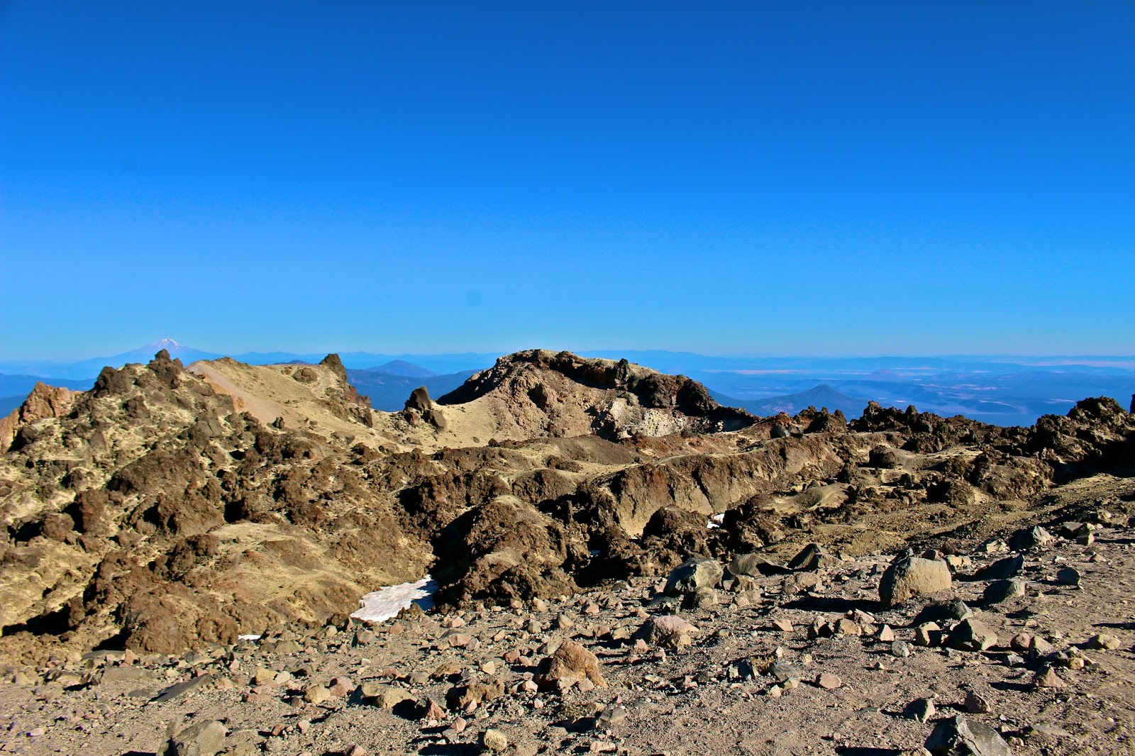
Yet, this is not the end… what is the point of hiking the highest peak in the park and not actually going to that point? Time to scramble.

From the offical summit, we had the park beneath us with views galore. Perfect spot to take a break and take it all in.

It was a wonderful hike, and I would recommend anyone in the Northern California area to visit and take the lil jaunt. On the way down we thanked the rangers working on the trail to prevent erosion, and encouraged those we saw heading up about how the views are worth the switch backs. Warning, boasting ahead: Stacy-pacy kicked butt! The literature and signage recommends the usual essentials and 4-5 hours to hike this feature, with our keep the same pace with no stops while on the trail and the time at the top, we did it in just over 2 hours! Not like we tried to speed up the hike, but the extra time left us means more features to explore!
In order to stay cool during the heat of the day, we went underground to explore the Subway Cave.

I did say that we went up 2 different types of volcanoes… So, next up was Cinder Cone, which is -you guessed it- a cinder cone volcano. This hike took us past beautiful lakes, along lava beds, and then up a very hot and dusty trail where each step up felt like you slid 3 steps back.

Seriously, it was a hardcore calf workout that got us sweating!

But at the top, you look out upon the Painted Sand Dunes, lakes, and views of the surrounding mountains and, don't forget looking into the middle of the cone.

As nice as Lassen Volcanic National Park is, it was also hot and dusty. We were ready for the shade of some big trees and salty breezes… Redwoods, here we come.

It was only a day's drive from one park to the other, but we used that drive time to research what to do. My readings lead me to want to hike within a particular grove: Tall Trees Trail, but that area needs an access permit, which they use to limit the number of people per day (hence why it sounded so pleasing). So, on our drive, I took the chance to call the visitor center to inquire about how to get a permit. Good thing I did because the ranger informed me that the permits needed to be applied for in person day of your visit to the grove but the ranger station/visitor center would be closed the next day due to an all staff meeting. So, she kindly said that if we could make it to the station before they closed, she would get us a permit and access code for the gate lock for the next day. So, pedal to the floor we booked it to claim a pass! After that, we knew what tomorrow held, so we just drove along Highway 101 and watched the trees loom over us, the mist shroud us, and the daylight fade away from us. *Cool fact: did you know that 40% of the coastal redwoods moisture intake comes from the fog?

First, it must be said that the whole Redwood Coast is interesting… Redwood National Park, Jedediah Smith Redwood State Park, Del Norte Coast Redwood State Park, and Prairie Creek Redwood State Park together form a World Heritage Site and an International Biosphere Reserve that Federal and State cooperatively manage. Sounds like a logistical nightmare to me, but I am glad theses places are all protected and connected with each other, even if I wasn't sure if I was in a National or State Park at any given time. Also, I found the accessibility so confounding. One second you are on a highway being tailgated by cars that just want to pass, the next you are so surrounded by greens and massive trees that roads seem a distant memory, the next you are on a cliff edge watching the waves of the Pacific thrash below you. It was like stepping (very quickly) from one world into another, then into another.

Tall Trees Trail, worth the effort of getting the access pass.

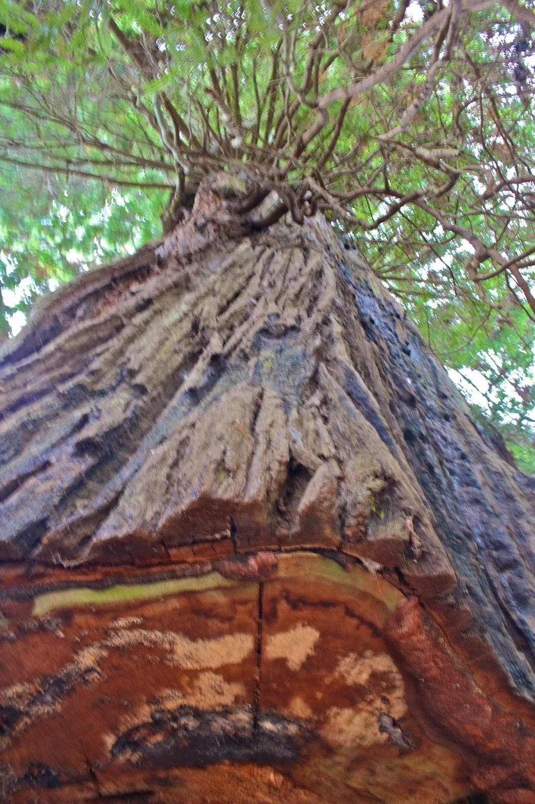
Starting early in the day, the light was beautifully tinted green as it attempted to break its way through all the leaves high above our heads. The air was crisp and you could just feel the bite in the wind between the trees. Basically, it was the perfect day for a hike. The actual trail is only 1.5 miles but it is steep, descending over 800ft in less than a mile. While you make your way down and down, rather than speeding up your pace slows as if trying to match the rhythm of nature around you. These trees have been here for hundreds of years, just waiting for me to join them. Stopping to look up and UP and UP is dizzying and exhilarating. The tops of trees are lost amongst the light, intertwining branches, and mist.

Yet, it isn't just standing amongst the tallest ancient trees on earth, the undergrowth amongst the fallen nursery trees and ferns and moss all add to this mystical place. The smells, colors, and feel of the trail were idyllic. If the kodama forest spirits were to be found anywhere on earth, it would be here.

Honestly, I do not even want to attempt to paint this place with any more words, because all would fail. So, just look at pictures, and even those cannot begin to capture the full scale and splendor. Best I could say is to go stand amongst the giants yourself when you can and just know what I mean then.


After the mystical morning on the Tall Trees Trail, we parked along the coast to reflect on where we were and over time we just let the crashing waves lull us into a lil nap. Recharged, we drove to Klamath Beach Road/Coastal Drive and explored more of the coast line and even visited the WWII Radar Station, a network of observation stations disguised as a working farm.

Our history-loving dads would all have loved these buildings, with their fake windows and dormers all concealing an early warning system. Another lesson in history was had on our way back, as we decided to take an exit off the highway to one of the "touristy" attractions to see a drive-thru tree. The lesson here is what NOT to do an amazing tree, leaving it with a scar only humans could inflict.
But we drove through it anyways (does that make us hypocrites?) and marveled that the tree lives on after what people did to it. Nature is amazing, we need it, and it is evident that it certainly does NOT need us.

The next day I decided that we would explore the Prairie Creek Redwood State Park.
Well... just say the morning was much less magical than the day before… More confrontational than magical actually as Karl & I had our first big fight of the trip. Hey, in our defense, we are living in very cramped quarters 24/7 with each other, this was bound to happen sooner or later. After separating ourselves from ourselves for about an hour, tears were shed (by me), apologies were made (both sides), deep breaths were taken, and then a reset button was pushed and we reattempted our hike. Nature is healing, and helps one be forgiving.

We wandered along trails to catch a glimpse of some noteworthy trees known within the park like Big Tree and Corkscrew Tree, both appropriately named. More fun facts: Did you know that redwoods as the world's tallest living trees, can grow taller than the Statue of Liberty (base included) and weigh more than 500 tons? The tallest tree at 379.1 feet in Redwood National Park is Hyperion, but the location is kept secret. *Keep it secret, Keep it safe*

The best part of the excursion, occurred as we took the Zig Zag #1 Trail to the West Ridge Trail, an area where you climb up to a ridge line and hike along looking down both sides with the trees starting feet below you yet still towering more feet above one's head. But, the trees were not the main entertainment on this trail this time, even as magnificent as they were.

As we walked along we began to notice very fresh and frequent scat, markings, and hoof prints along the trail. Getting exciting that we might come upon some elk amongst the ginormous growths we hiked faster and stayed quiet. After about half a mile of following the tracks, we hear a voice from the dense bushes on the one rocky ridge side, "HELLO? ARE YOU HUMANS?"
Ummm… Yes, humans we are… Why do you ask? Apparently, this middle aged couple from Georgia were hiking ahead of us earlier and got bluffed charged by a few bull elk! They were terrified and ran off trail, found a stash of maintenance equipment to arm themselves with, hid in the bushes, and called the rangers for help. Rangers asked if they could find a different way down away from the trail as it would take a while for a ranger to reach them, but they did not feel comfortable with that as they thought the elk were still around where we were and were afraid to leave until someone came to get them. The lady said she only called out to me because she saw my bright blue coat. So, we coaxed them out of hiding and they popped up out of those bushes wielding a rake and shovel and asked if they could hike with us the rest of the way. We, of course, agreed. Once they were "safe with us" they called the rangers back to tell them that someone "rescued" them already. It was kinda funny, watching them hike along with a rake and shovel, armed and ready, but they were sweet and good company to hike with. I do admit, I was kinda disappointed that we only saw a few cow elk in a clearing off the trail… I would have liked to get a glimpse of those aggressive bulk elk though!
At least Karl & I were not the most aggressive creatures in the park that day!

Once the couple was safe at the trailhead we said our goodbyes and wishes of lucky elk encounters for the future. And off we were to find our own animal interaction in Fern Canyon.

I loved this place. It was walking into a narrow canyon, where every inch of the walls are covered in fluffy green stuff! The ferns and mosses glisten as water trickles down with a continuous faint drip drip drip all around you.

Under your feet the rocks are colorful, and water twists and turns. You follow small planked foot bridges to help you navigate the wetter parts, or if you are Karl you just jump over the water or climb the fallen trees.

Although it might not be as pulse quickening as a happen upon with a bluffing elk, we got to watch a Dipper feast and plunge into the water and flutter upon the rocks in a beautiful place. It was awesome.


With the sun starting to set, we took one last trip out to the beach.

A ranger told us that where the Klamath River let out into the Pacific Ocean, was a great place to try to see sea lions feed.


It was worth all the sand in my boots to watch the sunset, the waves crash, the gulls dive, and the sea lions romp through the water. Understandable why the native people find this place to be sacred.

From salty water to soaring branches, Redwood was amazing.
I need to expand my vocabulary, especially utilize different adjectives as nearly everything we are seeing is amazing. (Please send unique adjective suggestions to starlkrenbic@gmail.com - haha) But, since I mentioned it already… Do you know what else is amazing to behold? Crater Lake.
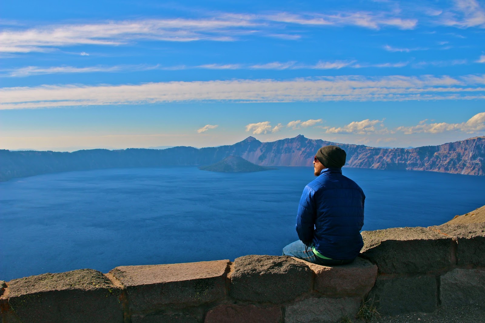
I began this blog post talking about the volcanic nature of Lassen and those same "under the surface turmoils" come back again here. But, it is daunting to wrap your mind around how such a beautiful place was born from such violent beginnings. What once was a grand mountain, Mount Mazama, is now Crater Lake National Park. Crater Lake by the numbers: depth of 1,943 feet at its deepest point (deepest lake in the United States); 4.54 miles (minimum) to 6.02 miles (maximum) across; holds 4.9 trillion gallons of water!
And oh, those waters… The bluest of blue waters, so pure from the centuries of snow melt and rain water, it is considered to be the cleanest waters in the world. The exceptional lake rests inside a caldera formed nearly 8,000 years ago. Later smaller eruptions formed a cinder cone now called Wizard Island, near the southwest shore of the lake. If you don't believe in the magic of nature, seeing this lake and Wizard Island should convince you otherwise.

After hearing from friends and reading other visitor accounts about not actually getting to see the waters of Crater Lake due to cloud cover, we realized that luck must have been with us. The day we arrived in the park, the sky was clear and almost as blue as the famous waters. We celebrated the sight with some cool brews we bought at the small market in the park!

To capitalize on the nice day, we took off to drive all the way around Crater Lake, both the East Rim Drive and West Rim Drive have overlooks and views galore. From the highest point on the road, and technically the highest paved point in all of Oregon (Cloudcap Overlook 7,960ft) to Discovery Point, where white men first glimpse this natural wonder, it is hard not to take too many pictures. With our late season arrival, the only trail that goes down to the water (Cleetwood Cove Trail) was already closed. Guess we'll just have to come back some other time to touch the pristine waters. But, before we got too ahead of ourselves planning future trips, we staked a claim at a site in Lost Creek Campground, so that we would have a place to enjoy the colors of the sunset.

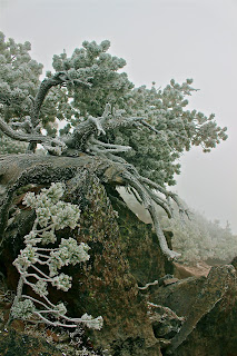
It was a good thing we took the time to explore, because the next day was opposite of the day before. Snow dusted everything like a sprinkling of powdered sugar, and winds that blew right through you, no matter how many layers were added. Well, when everything is cold and snowy either way, why not hike to the highest point in Crater Lake National Park?

We were planning on doing Mount Scott (8.929ft), so we stuck with the plan. It was quite entertaining to be honest. The hoar frost the was clinging to the blades of grass or the tiniest ledges of rock, were sparkling wonders to see. The crystal like structures, so fragile looking were weathering intense winds with determination.

Since we were the only ones crazy enough to hike in the blizzard like conditions, we had the whole trail to ourselves to enjoy. But, over time the cold does get to you. So, after a quick glimpse at the top (the views were all gray cloud) we decided to descend quickly, by dancing down the 5 miles. Yes, dancing! Karl had his tablet on him, so a few epic songs were chosen and down we went with many a creative moves. After a few miles, we looked back up the trail and just laughed, knowing that if anyone DID come up this trail later that they would be really confused by the insane and apparently drunken footprints that didn't seem have any rhyme (or should I say rhythm) or reason coming down the trail. Snow dance hiking downhill is fun, and fast! I was pink cheeked, Karl had an icicle mustache, but both of us breathless and no longer freezing. The only 2 "dance breaks" were once for Karl to stop to talk to a ptarmigan, and 20 feet from the parking lot when we spotted other people. We only dance for ourselves ;)
We attempted a few other short hikes to lookouts after Mount Scott, but everything looking like this:

We gave up and since we just passed 4 months on the road, we treated ourselves to lunch and an extremely over priced bottle of wine at the Crater Lake Lodge. I sipped and enjoyed every penny's worth of that red wine by the fireplace in the lodge. It was worth it.
The wine warming our bellies, spirits, and possibly blurring our judgement (the fact that a trailhead started just outside of the Lodge, didn't help), we decided to attempt another hike to Garfield Peak (8,054ft). I think the weather gods must have found our earlier dancing pleasing (or at least entertaining) because when we got to the top, the clouds lifted enough to see the lake and snap a few more pictures!

Our campsite was on Pinnacles Spur Road, and if you continued past the tents and trailers you would end up at the Pinnacles Trailhead where volcanic spires jut up along the sides of the canyon walls.

Further down the trail, you could find an old entrance to the park and boarder of the Winema National Forest. A sign used to hand here, but since it was missing, Karl decided to hang there instead.

That night, we witnessed a peaceful sunset over the Crater Lake. I've used too many words already… Just look.

Alas, we cannot stay, more adventure calls.
9/25/2016-10/2/2016
9/25/2016-10/2/2016
<3 S
No comments:
Post a Comment
Well then...